The Territorial Division Directory provides information on provincial and federal administrative divisions, as well as part of Statistics Canada’s Census geography.
The Directory is centered around Québec municipal divisions (including local municipalities, Aboriginal territories and unorganized territories).
In addition, this tool allows you to carry out multi-criteria searches and to discover the history or obtain a personalized list of municipalities.
Interactive mapping Updated: April 12, 2024
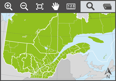
You can use the territorial division interactive mapping tool to view several Québec administrative divisions simultaneously.
A user guide outlining the tool’s possibilities is available.
Publications
- Modifications aux municipalités du Québec (annual and monthly report) Updated: April 12, 2024
- Historique des modifications aux municipalités du Québec. Période 1961-1990
- Système du code géographique du Québec – Guide explicatif et lexique
- Standardized lists of codes and names of territorial divisions
- Municipal status symbols
Databases
- Québec Geographical Code files – Portrait of municipalities and history of changes Updated: April 12, 2024
- Geography of the 2021 Census of Population harmonized with the Québec geographic base
Updates and sources
Updates for the previous month are done every month. They are recorded in the Modifications aux municipalités du Québec bulletins.
For more information about the sources used for area and population data, please consult this table.
Territory areas are estimated based on the Système sur les découpages administratifs (SDA) of the Ministère de l'Énergie et des Ressources naturelles. Land areas are calculated by the Institut using the National Hydro Network (NHN) distributed by Natural Resources Canada (compilation of hydrographic data at 1:20 000 and 1:50 000 scales). Areas are calculated based on the Albers equal-area conic projection for Québec (NAD83).
In the event of any discrepancy between the data published on this site and that found on the website of its producer, the latter prevails.
 Subscribe to the Directory